As the CEO, Ajith Chandran is known for his visionary leadership. He is committed to leveraging cutting-edge geospatial technologies to address pressing environmental challenges. Under his guidance, the company has embarked on innovative projects that integrate satellite imagery, GIS (Geographic Information System), and advanced analytics to monitor and manage environmental resources.
Mr. Ajith Chandran is a passionate advocate for sustainability and environmental conservation. He actively engages with government bodies, non-profit organizations, and industry stakeholders to promote sustainable practices and the responsible use of geospatial technologies for environmental monitoring. His commitment to corporate social responsibility is reflected in the company’s initiatives aimed at minimizing its ecological footprint.
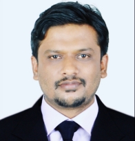
Mr. Krishna Lodha
Program Head
Krishna Lodha is primarily an open source enthusiast.He has heavily invested in GIS open source software development for a decade and is an active member in sharing the knowledge via various platforms such as YouTube, Medium, etc. He has been actively contributing to lot of open source projects and trainings in Geospatial Campus using PostGIS, Geoserver, Pygeoapi, etc.
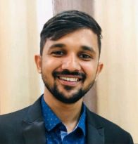
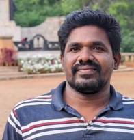
Mr. Akhil Dhananjayan
Centers Coordinator
He is a dedicated and results-driven professional with a Master of Business Administration (MBA) degree and a proven track record of success in strategic planning, team leadership, and project management. Adept at developing and implementing innovative strategies to drive business growth, improve operational efficiency, and enhance overall performance. Mr. Akhil Dhananjayan possesses strong analytical, communication, and decision-making skills with a commitment to achieving organizational objectives.
Expert Panel
Dr. Aran Castro PhD
Research Coordinator &GIS Trainer
He completed his PhD in 2022 and has a strong enthusiasm for applied geology. He has published more than eight publications in reputable journals covering a variety of geospatial science verticals, offering the scientific community insightful information. With his mastery of Python and ESRI ArcGIS software, he has researched environmental hazards to native species in Tasmania, Australia, and used the soundscape approach and noise mapping techniques in a case study in Chennai, India.
Dr. Rajkumar Perumal PhD
Research Coordinator &GIS Trainer
He completed his PhD in 2017in geological science from Annamalai University, INDIA. He has published more than 12 research articles in reputable journals and has published3 books connected to geology.He hasapplied GIS and Remote sensing tools in petroleum exploration and disaster management and he has over 5 year experience in corporate training domain.
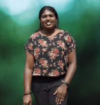
Ms. Aswathi Das N
Urban Planner& GIS Trainer
She has a great foundation in civil engineering and a wealth of knowledge in the field of urban planning. She can drive effective solutions for geospatial analysis, urban planning, and civil engineering using AutoCAD, ArcGIS, ArcGIS Pro, QGIS, Sketchup, and Global Mapper.
Ms. Bhavana Kuttappan
Hydrologist& GIS Trainer
She has a post-graduate degree in hydraulics engineering and an undergraduate degree in civil engineering. She is currently using this knowledge to greatly improve the hydraulic components of numerous GIS projects. She is skilled in Google Earth Pro, ArcGIS Pro, HEC-RAS, GeoHEC-RAS, Matlab-ANN, ArcGIS, QGIS, WaterGEMS, AutoCAD, and ECP.
Mr. Neeraj B
Geographer and GIS Trainer
Along with his great expertise with GIS desktop software, including ArcGIS and QGIS, he has experience with cartography and spatial analysis. His master’s degree in geography has allowed him to effectively apply his knowledge in a variety of initiatives, from disaster relief to transportation planning.
Mr. Sadique Muhammad
Geologist and GIS Trainer
With a postgraduate degree in geology, he specializes in the analysis and visualization of geological data using geospatial tools including ArcGIS, ArcGIS Pro, QGIS, Google Earth Pro, and ArcPy. In addition, he has good programming abilities in Python and JavaScript and is skilled in AutoCAD, Global Mapper, and SketchUp. His knowledge of HTML and CSS web development rounds out his comprehensive skill set.
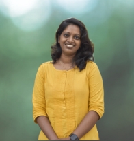
Ms. Susmita D
GIS Back-end Development Trainer
Susmita is a seasoned back-end developer with over a decade of expertise in GIS and web development. Proficient in Python, JavaScript, and PHP frameworks, she navigates seamlessly through various SQL and No-SQL databases, adeptly crafting solutions to intricate geospatial challenges using open-source stacks. Her daily endeavors involve tackling complex problems with vector and raster data, showcasing her proficiency in spatial analysis and problem-solving within the realm of backend development.
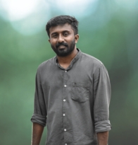
Mr. Sourav D
GIS Front-end Development Trainer
Sourav brings over 8 years of front-end technology experience to the table, beginning his journey with HTML, CSS, and JavaScript and evolving into a proficient developer crafting intricate applications utilizing Next.js and React.js frameworks. His daily routine involves the visualization of extensive datasets on maps employing a diverse array of open-source tools, showcasing his adeptness in creating dynamic and interactive user interfaces. Furthermore, Sourav actively contributes to open-source projects, demonstrating his commitment to collaborative development and community enhancement within the realm of front-end technology.