
6-Month Integrated GIS Flagship
Our complete, job-ready programme covering the full geospatial stack, with a 1-month internship.
- GIS, Remote Sensing & Geo-AI
- Python and Web GIS
- 1-month internship
EdTech and GIS training institute under SysGlob Software Solutions Pvt. Ltd. Industry-oriented GIS, Remote Sensing, Python-for-GIS and Geo-AI training, delivered from Kochi since 2013. More than 2,000 learners trained and 800+ placed across Indian and international firms.
See where training at Geospatial Campus can take you, from live projects and industry tools in the classroom to placements at Wipro, AECOM, Infosys and beyond. Watch the story.

“Our focus has always been simple: train people for real geospatial jobs, not just certificates. Every batch works on live datasets and industry tools, the same way our teams deliver projects at SysGlob. If you are ready to build a career in GIS, we are ready to train you.”
From foundational GIS to Python automation and AI-driven analysis, and each track is project-based and placement-focused.
Our complete, job-ready programme covering the full geospatial stack, with a 1-month internship.

Flagship programme, graded from beginner through intermediate to advanced learners.
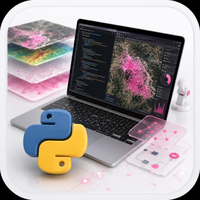
Automation and scripting for repeatable geospatial workflows.

A newer programme combining spatial data with modern AI techniques.
The institute prioritises application over theory. Each module is anchored to a deliverable that mirrors industry tasks.
Landsat, Sentinel, SRTM and Survey of India data used from day one.
ArcGIS Pro, QGIS, ENVI, ERDAS, Google Earth Engine, Python.
Small batches with direct access to practising GIS professionals.
Mock interviews, portfolio review and referrals to partner firms.
Alumni work at Wipro, AECOM, Infosys, Map My India, Accenture and public planning bodies across India.




Tell us your background and the track you want. We'll call you back within one working day with batch dates, fee structure and a free demo class invite.