Advanced GIS Training
Flagship programme, graded from beginner through intermediate to advanced learners.
- ArcGIS Pro and QGIS workflows
- Spatial analysis and geoprocessing
- Data handling, topology and visualisation
- Mapping, cartography and layouts
Start with GIS fundamentals, then move on to Python automation and AI analysis. Every module uses real satellite and survey data and the software employers ask for.
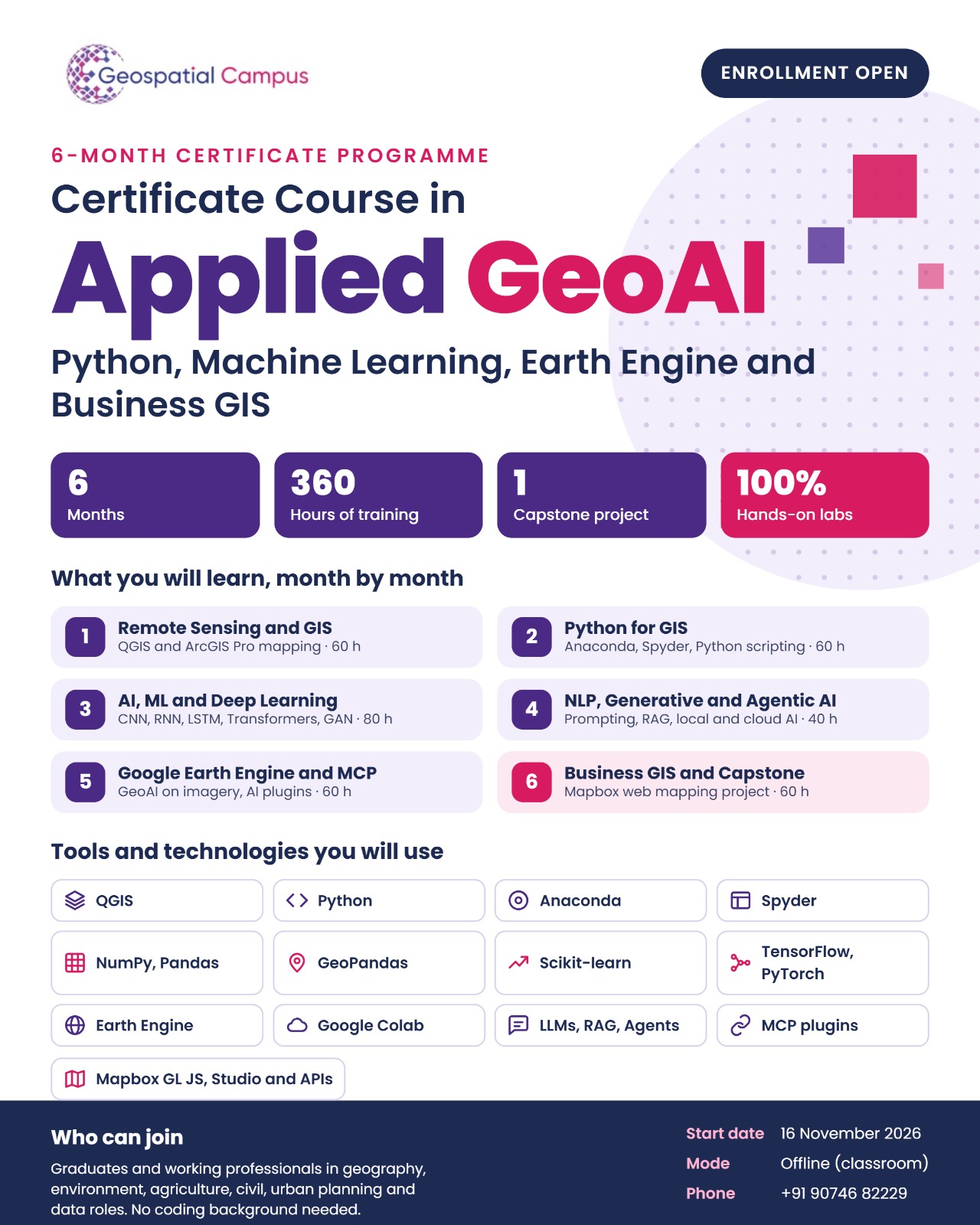
Python, Machine Learning, Earth Engine and Business GIS in one programme. Go from your first QGIS map to deep learning on satellite imagery, generative and agentic AI, and a Mapbox web-mapping capstone.
Who can join: graduates and working professionals in geography, environment, agriculture, civil, urban planning and data roles. No coding background needed.
No. The course starts with Remote Sensing and GIS in month one and teaches Python for GIS in month two, before any machine learning.
Graduates and working professionals in geography, environment, agriculture, civil engineering, urban planning and data roles.
The next batch starts on 16 November 2026. It runs for six months: 360 hours of training, all of it in hands-on labs, ending with a capstone project.
Offline. Call or WhatsApp +91 907 468 2229 to confirm the batch nearest to you.
Map in QGIS and ArcGIS Pro, script GIS work in Python, train deep-learning models on satellite imagery, use generative and agentic AI and Google Earth Engine, and build a Mapbox web-mapping project for your portfolio.
Yes. Placement support includes mock interviews, portfolio review and referrals to partner firms. See where our alumni work on the placements page.
Send us a WhatsApp message, call us, or fill in the form below and we will send both.
These six areas run through every track we teach.
Geographic Information Systems, the foundation, taught from data modelling to advanced analysis.
Optical and radar imagery, pre-processing, classification, thematic mapping.
Geoprocessing, overlay analysis, geostatistics, hydrology and terrain modelling.
ArcPy, GeoPandas, Rasterio and Shapely for automating spatial workflows.
Deep learning on satellite imagery, land-cover classification, feature extraction.
Layout design, symbology, print and web cartography for planning and communication.
Choose a track based on your goal. Not sure which fits? Talk to a mentor for a free guidance call.
Flagship programme, graded from beginner through intermediate to advanced learners.
Automation and scripting for repeatable geospatial workflows.
Python, Machine Learning, Earth Engine and Business GIS in one 360-hour programme.

Build and deploy interactive maps and spatial web applications.
Pick your track, campus and whether you'd like to learn online or offline. We'll call you back with next batch dates, fee structure and a free demo invite.